Montrose/Uncompahgre Plateau Trail Descriptions
To see all trails listed be sure to scroll down the page
In close proximity to the City of Montrose, one can find a wide variety of off-road trails ranging from easy to extreme rock crawling. On the Uncompahgre Plateau, one can find many side trails not listed here. Many are in actuality short loops bringing you back to Divide Road which is considered the main road over the plateau. This page divides the trails into two sections, Extreme/Rock Crawling and General Off Road.
It is recommended that you travel with other vehicles and for the extreme rock crawling trails, be prepared for vehicle damage and the need to have your vehicle towed or the need to walk. Be prepared for general survival needs as these Extreme trails are in somewhat remote locations from main roads and highways.
Extreme/Rock Crawling Trails
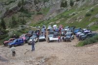
Take your off-road experience to the extreme on six rock crawling trails located just a few miles west of Montrose, Colorado, in the Dry Creek area of the Uncompahgre Plateau.
Calamity Canyon, Topless, Death Row, Die Trying and Cactus Ridge trailheads are all accessed off of Rim Road. There is a parking lot on Rim Road near the intersection of Rim Road and Shavano Valley Road. The Calamity Canyon turn-off is to the right 1.75 miles past the parking lot. The turnoff to Topless, Death Row, Die Trying and Cactus Ridge turn-off is to the right 4.5 miles past the parking lot.
These trails require a special blend of skill, machinery and guts. Broken parts and body damage should be expected. A winch and lockers are required on all trails.
Driving Directions
Dry Creek Staging Area – From Montrose head southwest on CO-90 (West Main Street) approx 1.9 miles from Townsend Ave where it will turn into Spring Creek Rd. Continue on Spring Creek Rd approx 4.2 miles to 5875 Rd. Turn north on 5875 Rd and follow approx 3.1 miles to Kiowa Rd. Turn west on Kiowa Rd and continue approx 0.8 miles to Shavano Valley Rd. Turn south onto Shavano Valley Rd and follow approx 0.2 miles to Rim Rd. Turn west onto Rim Rd to access trails.

Boulder Canyon – Rated 10+ (Closed from December 1 to April 15.)
The trail starts a few hundred yards off of 90 Road and heads up a small canyon. There are a couple of small obstacles in the first few hundred feet. If you have trouble with these, walk ahead and take a look. The next few hundred yards are littered with monster boulders, off-camber climbs and huge holes. The trail gets easier for several hundred yards until you get to “The Waterfall”, a 10 to 12 foot high shelf that will get your motor running. Your blood pressure will return to normal as you take a short drive in the canyon to a left turn that takes you to the top. Turn left to return to Rim Road.
Getting there: The Boulder Canyon trailhead is located off of Highway 90 eight miles west of Montrose. There is a parking lot on the left, one-quarter mile past the end of the pavement on Highway 90. The trailhead is three-quarters of a mile past the parking lot located to the right.
Calamity Canyon – Rated 6 to 9 (depending on route options)
This is a small canyon that has two side loops that add to the difficulty – both can be bypassed, but the exit cannot. The first loop goes up a couple of steep ledges into a small drainage where the trail turns right and loops back into the canyon. The second loop leaves the canyon to the right and has a boulder field on the approach to several uphill ledges. At the top turn left to return to the canyon. The exit has numerous large boulders on the approach. There are three exit options: to the right is a steep climb; the middle is an undercut ledge; to the left is a huge boulder. At the top is Power Line Road – turn left to return to Rim Road.
Cactus Ridge – Rated: 8
The trail goes up a small drainage to the first obstacle, which is a long field of boulders that continues for about 200 yards. The trail then smooths out and winds its way up to a split. To the right is the original trail that leads to a large waterfall. To the left is Cactus 2, which leads to a hill covered with large, loose boulders. The trails come back together at the top and continue on a steep downhill section covered with loose dirt and small rocks. This road loops around and back to the start of the trail. Continue the way you came in to return to Rim Road.
Death Row – Rated 10+
The entrance is a right turn off of Topless, about a half mile in. The first hundred yards are small ledges and boulders that do not live up to the rating. Then the real trail starts – boulders the size of cars and holes that will swallow one. The trail is very tight and does not offer many options for lines. There is one obstacle after another for about 200 yards while gaining elevation at a rapid rate. Then the trail levels off for a few hundred yards before a small ledge at the exit joins a two-track that will return you to Rim Road in about 1½ miles.
Die Trying – Rated 8
This trail starts with quite a few large boulders, ledges and notches. After a few hundred yards the trail smooths out to smaller boulders and ledges and some tight turns around some large rocks. Near the end the trail takes a hard left turn to a long, steep, rough climb out of the canyon. There is a split at the end; to the right is the original exit or to the left is a new exit which can be much more difficult. At the top follow a two-track about 1.5 miles to return to Rim Road.
Scratch and Dent – Rated 6
The Scratch and Dent trailhead is on the entrance road to Calamity Canyon, about ¼ mile from Rim Road. There is a small sign to the left at the bottom of the first small draw, indicating the start of the trail. The trail continues up the draw and is mostly smooth sand and a few small boulders. At about ⅓ mile it passes through a fence with a gate (please leave gate as you found it). About 100 yards past the gate, the trail begins a rocky section that climbs up out of the draw. The rocky section continues for about 100 yards. When you get to the top, turn left and continue for about ¼ mile to the Calamity Canyon entrance road. Turn right to return to Rim Road.
Topless – Rated 7
The first half mile is a tight, rocky wash-bottom that leads to the first obstacle. This is the obstacle where the trail got its name. The tree that leaned across the ledge you have to climb is now gone. The trail continues up a tight wash filled with boulders and ledges for the next half mile. Then it widens before it joins the exit road from Die Trying and Death Row. Turn left to return to Rim Road.
General Off Road Trails
This listing will include trail descriptions of basic to intermediate trails located within a short driving distance from the City of Montrose. We are working to provide “Flip-Books” for all of our trails listed. Simply click on the Flip Book of the trail of interest. You can click on the full screen in the lower left corner of the book. Each book contains description, direction, map and photos of the trail. Each of these books may be printed for your use while on the trail.
Roubideau Loop – Rated 5
A nice scenic trail with a trail difficulty rating of 5. The trailhead is located about 60 minutes from Montrose. It’s recommended to have a limited -slip or a locker due to some steep slipper hills.
Smith Mountain – Rated 3
This scenic trail begins in the Peach Valley off-road area North of Montrose and winds along a steady climb to a few over-looks viewing the Black Canyon and the Gunnison River.
Tabeguache Jeep Road – Rated 5+
Located West of Montrose on the Uncompahgre Plateau, the trail head is about 60 minutes from downtown Montrose. A high scenic trail running through mostly Aspens and assorted pines. Be aware you will see a lot of wildlife and you are cautioned that this is an open range area so you may run into grazing cattle wandering along or in the trail.
Divide Road – Rated 2
This is basically a county road which travels through USFS and BLM lands and is quite scenic. The trail head, located due West, is about 30 minutes from downtown Montrose. If you travel the entire length, you will have the option of turning East and proceeding to the town of Delta or continuing West and eventually ending on the highway in the town of Gateway.
Wave/Eagle – Rating: 4+
A nice loop trail just North of Montrose in the Peach Valley Off-Road area.
Olathe Reservior Road – Rated 3
The Olathe Reservoir Trail is an easy route which leads to a dead end in the upper reaches of the Dry Creek Basin – a hidden pocket in the eastern slope of the Uncompahgre Plateau. Once you are there, it may seem miles farther from civilization than it is.
The route starts out following the Rimrocker Trail, but only for a short distance before turning north on Rim Road. After following the eastern rim of Dry Creek Basin for a few miles, the trail makes a hairpin turn onto a shelf road down into the basin. The shelf road has an off-camber spot which may make you feel tipsy. From there the trail traverses the head of the basin, ending near a neat wall of rock pillars, and reservoirs owned by the Town of Olathe.
Please send us your comments or corrections to contact@ws4w.com.